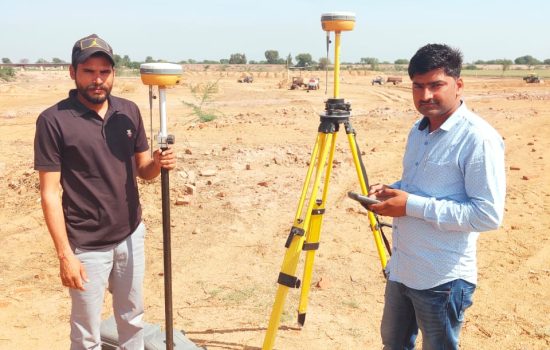
DGPS (Differential Global Positioning System) surveying provides highly accurate, real-time positioning data by correcting GPS signals using a network of ground-based reference stations. This technology ensures centimeter-level precision, making it ideal for complex surveying tasks such as land mapping, boundary demarcation, and infrastructure development. DGPS surveying significantly reduces errors that might occur with traditional GPS, offering reliability and accuracy even in challenging environments. At Engineer’s Point, we utilize DGPS surveying to deliver precise geospatial data for projects ranging from construction and land development to environmental monitoring, ensuring that your project is built on the most accurate foundation.

DPR (Detailed Project Report) is a comprehensive blueprint that outlines the scope, costs, and timelines of a project. It includes an in-depth analysis of resources, labor, materials, and environmental factors. By assessing potential risks and providing cost estimates, the DPR ensures a clear path from initiation to completion. At Engineer’s Point, we create detailed, tailored DPRs that provide our clients with the insights needed for informed decision-making. Whether it’s for construction, real estate, or infrastructure, our DPR services streamline project planning, enhance efficiency, and ensure that each phase stays within budget and on schedule.
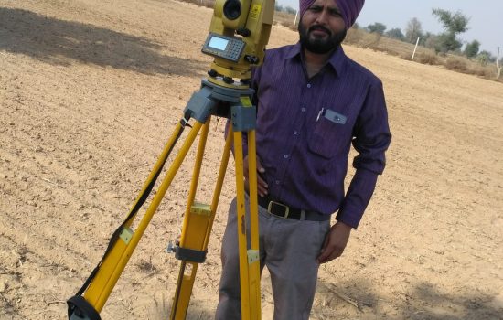
Total Station Surveying combines electronic theodolite and distance measurement technology to provide highly accurate topographical data for land mapping, construction, and infrastructure projects. By measuring both horizontal and vertical angles along with distances, Total Station ensures precision in capturing geospatial data. It significantly enhances the speed and accuracy of surveys compared to traditional methods. At Engineer’s Point, our expert surveyors use advanced Total Station equipment to deliver reliable data for site analysis, boundary surveys, and construction planning. This technology ensures that every project is built on a foundation of accurate, real-time measurements for optimal results.
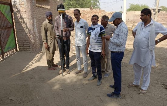
Demarcation is the process of establishing clear property boundaries using precise surveying techniques, legal documentation, and physical markers like stakes or fences. This process helps avoid disputes and ensures that landowners understand the exact limits of their property. At Engineer’s Point, we provide expert demarcation services that accurately define and mark property lines according to legal and regulatory standards. Our team uses advanced surveying tools and technologies to ensure that boundaries are set with precision, offering landowners peace of mind and legal clarity. Whether for residential, commercial, or industrial projects, we guarantee accurate and reliable demarcation services.
“90-A Approved” refers to projects that meet the regulatory standards outlined in Section 90-A of government of Rajasthan ensuring that developments follow legal and procedural guidelines for real estate projects. This approval confirms that the project adheres to all necessary regulations, including land title, layout plans, and construction standards. At Engineer’s Point, we assist in obtaining 90-A approval for your real estate or construction projects, ensuring full compliance with RERA guidelines. This approval not only ensures transparency and accountability but also enhances project credibility, making it easier for clients to trust and invest in your developments.
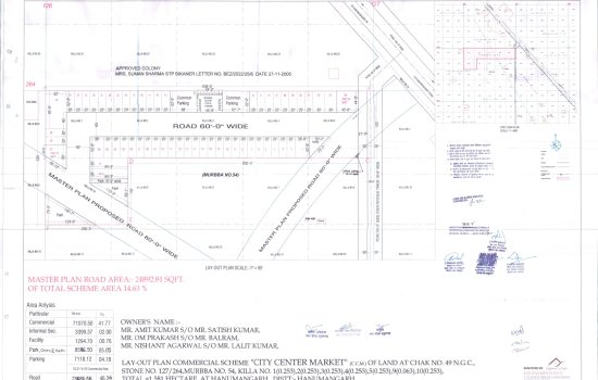
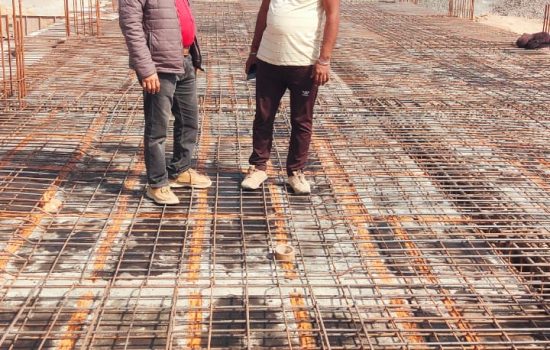
Supervision plays a crucial role in ensuring that every phase of a project is executed according to the highest standards of quality and safety. At Engineer’s Point, we provide expert supervision throughout the lifecycle of your project, from planning to execution. Our team closely monitors construction processes, ensuring adherence to design specifications, compliance with safety protocols, and timely completion of tasks. With regular site inspections and clear communication, we minimize risks, avoid delays, and ensure that the final product meets both regulatory standards and client expectations. Trust our supervision services to bring your project to successful fruition.
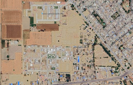
Township planning involves the strategic design and organization of residential spaces to create well-organized, functional, and sustainable neighborhoods. At Engineer’s Point, we specialize in transforming vacant land into vibrant communities by carefully planning infrastructure, roads, utilities, and green spaces. Our experts focus on optimizing land use, integrating essential services, and ensuring compliance with local regulations. We emphasize creating a balance between residential, commercial, and recreational areas while fostering a sense of community. Notably, we have successfully planned Shree Anand City-I & II, Rajasthan’s largest private khatedari residential & commercial Township, located in Hanumangarh on Sriganganagar Road. Whether for residential colonies, gated communities, or mixed-use developments, our planning services ensure that your project thrives with efficiency, accessibility, and long-term sustainability.
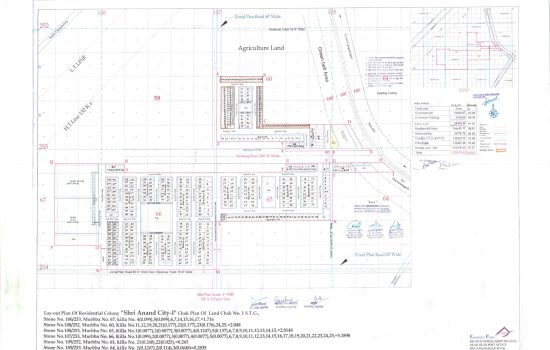
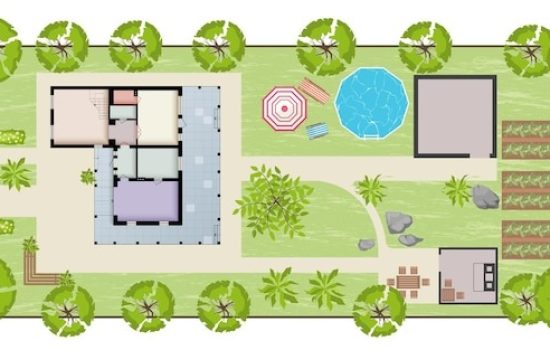
At Engineer’s Point, we provide comprehensive services in both landscaping and house planning to create functional, aesthetic, and harmonious living spaces. Our landscaping designs focus on blending nature with architecture, offering everything from garden layouts to water features and hardscaping that enhance the overall environment. Alongside this, our house plans are tailored to maximize space utilization, functionality, and comfort while adhering to architectural standards. Whether designing your dream home or transforming your outdoor space, our expert team ensures that every detail is carefully planned to create a beautiful and sustainable living experience.
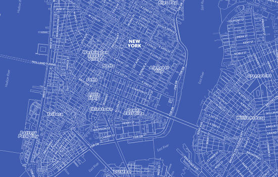
Google Map Blueprint is an innovative solution that integrates Google Maps data to create precise site layouts and geospatial visualizations. By utilizing satellite imagery and mapping tools, we can plan routes, mark property boundaries, and analyze topography with exceptional accuracy. This technology helps in effective land use planning, construction site management, and infrastructure development. At Engineer’s Point, we use Google Map Blueprint to offer clients accurate visual representations, aiding in strategic decision-making and project execution. Whether for real estate, construction, or urban planning, our Google Map Blueprint services provide an essential foundation for successful project outcomes.
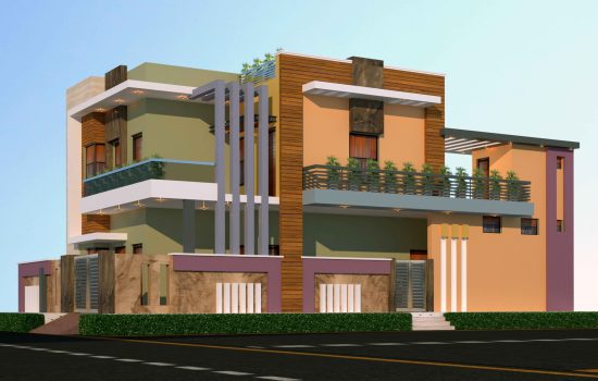
2D and 3D elevation designs offer a clear visual representation of how a building or structure will appear from various angles. At Engineer’s Point, we specialize in creating both 2D and 3D elevations to provide clients with an accurate preview of their projects before construction begins. The 2D elevation offers a flat, detailed view of architectural elements, while the 3D elevation brings designs to life with realistic perspectives, colors, textures, and lighting. These visualizations help in decision-making, ensuring that all design elements are aligned with client expectations and project requirements, enhancing the overall aesthetic appeal of the final structure.
A well-crafted house plan is the foundation of a comfortable, functional, and aesthetically pleasing living space. At Engineer’s Point, we specialize in creating customized house plans that reflect your lifestyle, preferences, and future needs. Our expert architects and designers work closely with clients to design layouts that optimize space, ensure natural lighting and ventilation, and comply with local building codes. Whether it’s a compact modern home or a spacious villa, we focus on every detail—from room placement to structural safety. With 2D layouts and 3D visualizations, we help bring your vision to life, ensuring your dream home starts with the perfect plan.
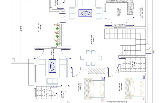
A blueprint is a detailed technical drawing that serves as the foundation for any construction project, outlining the structure, layout, and essential specifications. At Engineer’s Point, we create accurate and comprehensive blueprints that guide every stage of development—from initial design to final construction. Our blueprints include floor plans, elevation views, structural details, and utility layouts, ensuring that architects, engineers, and contractors are aligned throughout the project. Whether it’s for residential, commercial, or industrial construction, our expertly crafted blueprints ensure compliance with codes, eliminate guesswork, and help avoid costly mistakes. Trust us to bring clarity and confidence to your building process.

Expert consultancy guiding you through seamless RERA registration for compliant and hassle-free real estate projects.
